
Expert Consultancy in Integrated GIS, Climate, Water, and Agriculture Solutions
At ClimaQuantis, we offer scientific expertise in GIS applications, data science, climate change assessment, precision agriculture, and water modeling to drive transformative environmental solutions.
Our dedicated team applies advanced analytical methods and innovative technologies to tackle complex challenges, enabling communities and industries to adapt effectively to a rapidly changing world.


Our Mission
Why Choose Us?
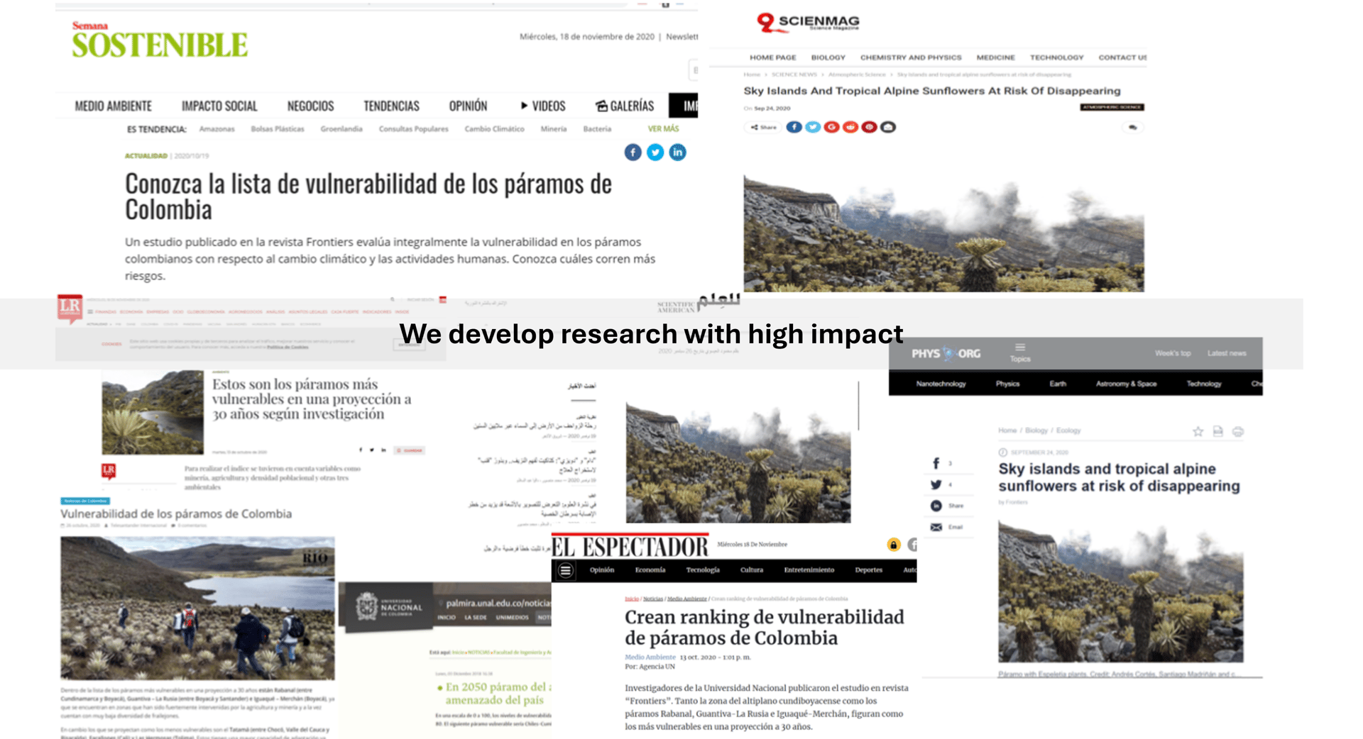
High Quality Research: Delivering precise, impactful studies.
AI Applications: Leveraging advanced artificial intelligence techniques.
Research Transparency: Open and replicable research practices.
Experienced Researchers: Each team member brings nearly 10 years of expertise.
Evidence-Based: Findings supported by high quality scientific publications.
Experts providing high quality solutions with evidence-based science.


What we do?
Species Distribution Modeling
Advanced modeling of multiple species distributions
Full quality control from start to finish
Clear spatial maps and result interpretation
GIS Applications
Training for your team (R, QGIS, ArcGIS, Python)
Proven methods for location-based solutions
Custom maps to fit any need
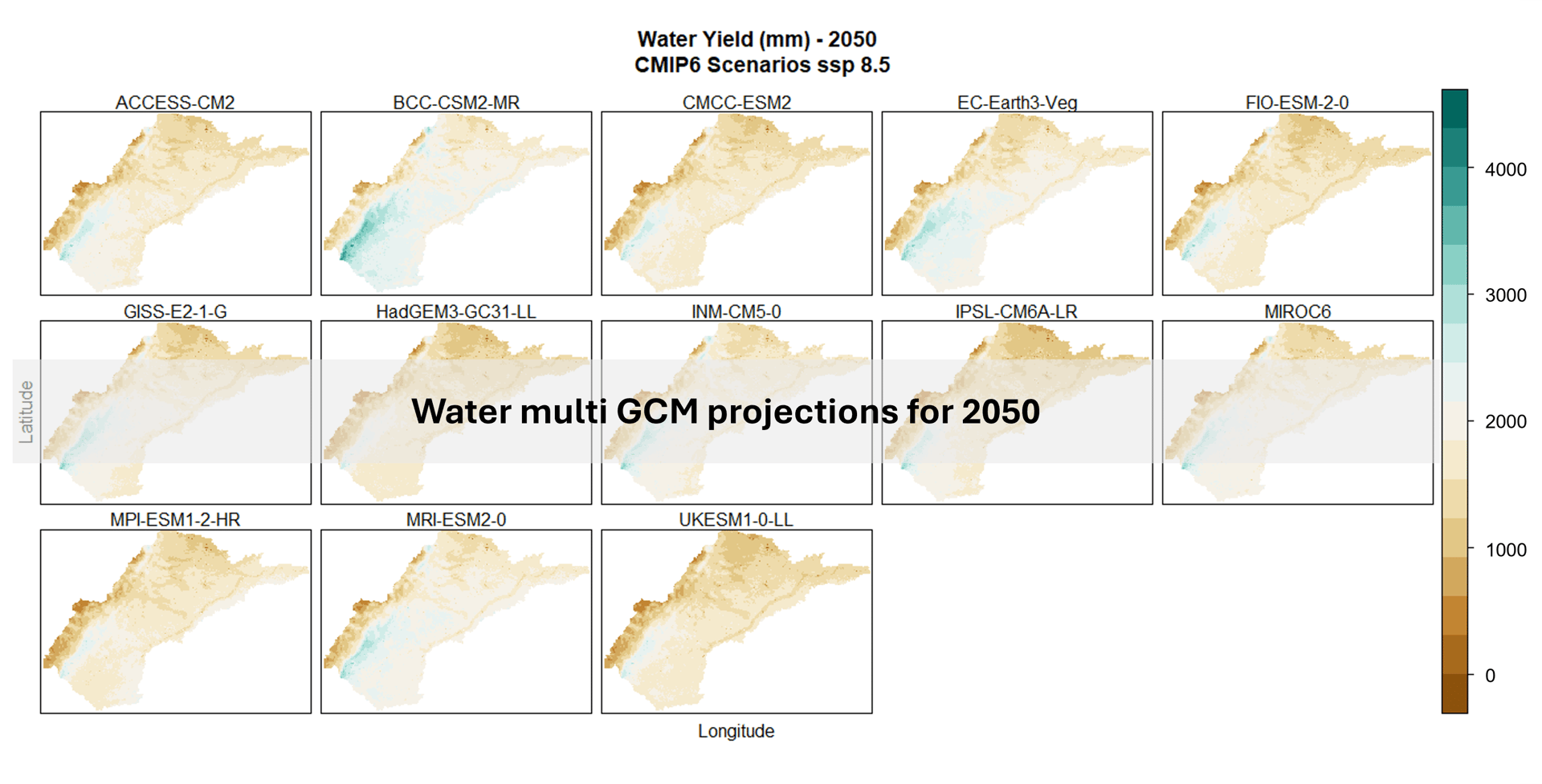
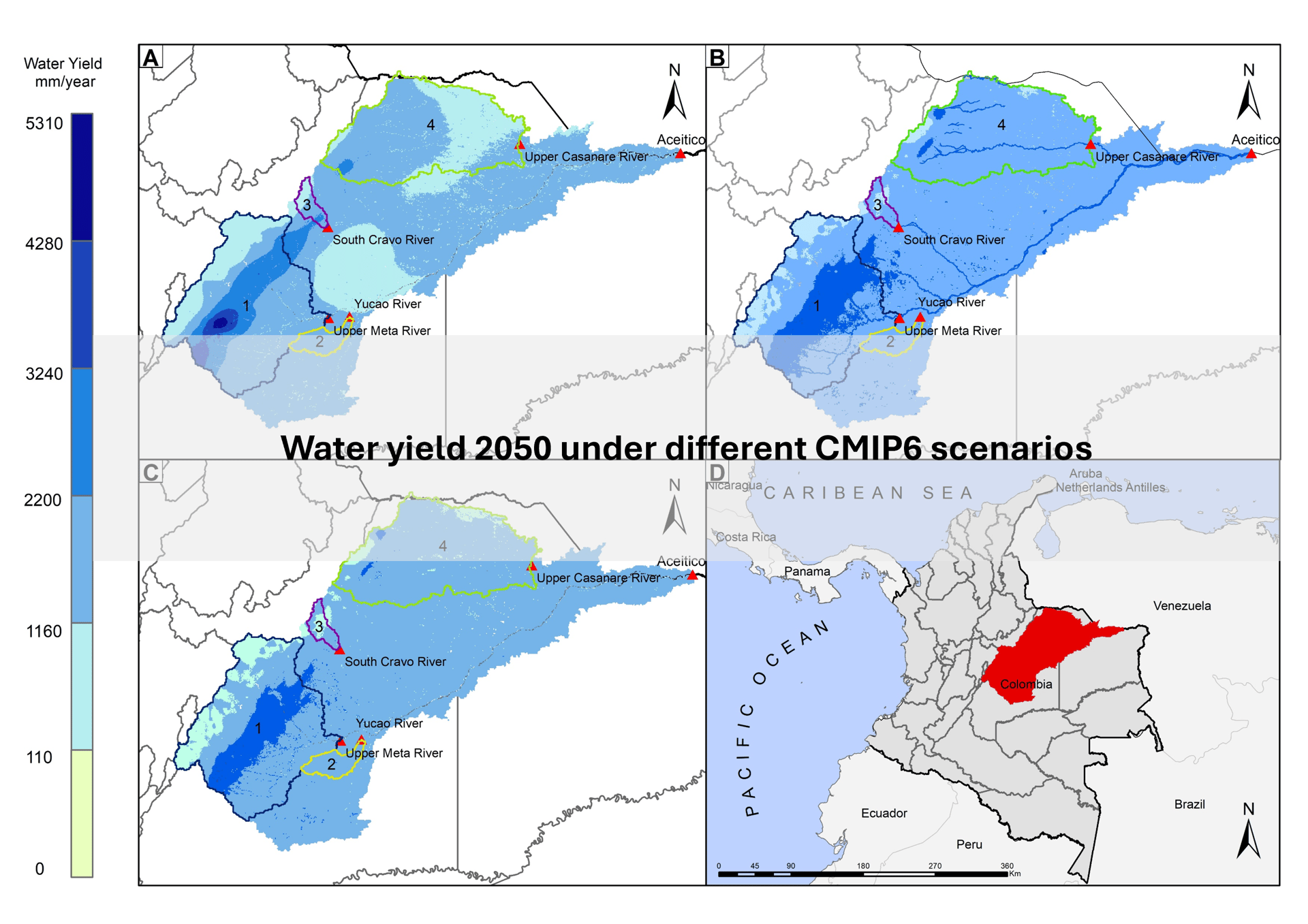
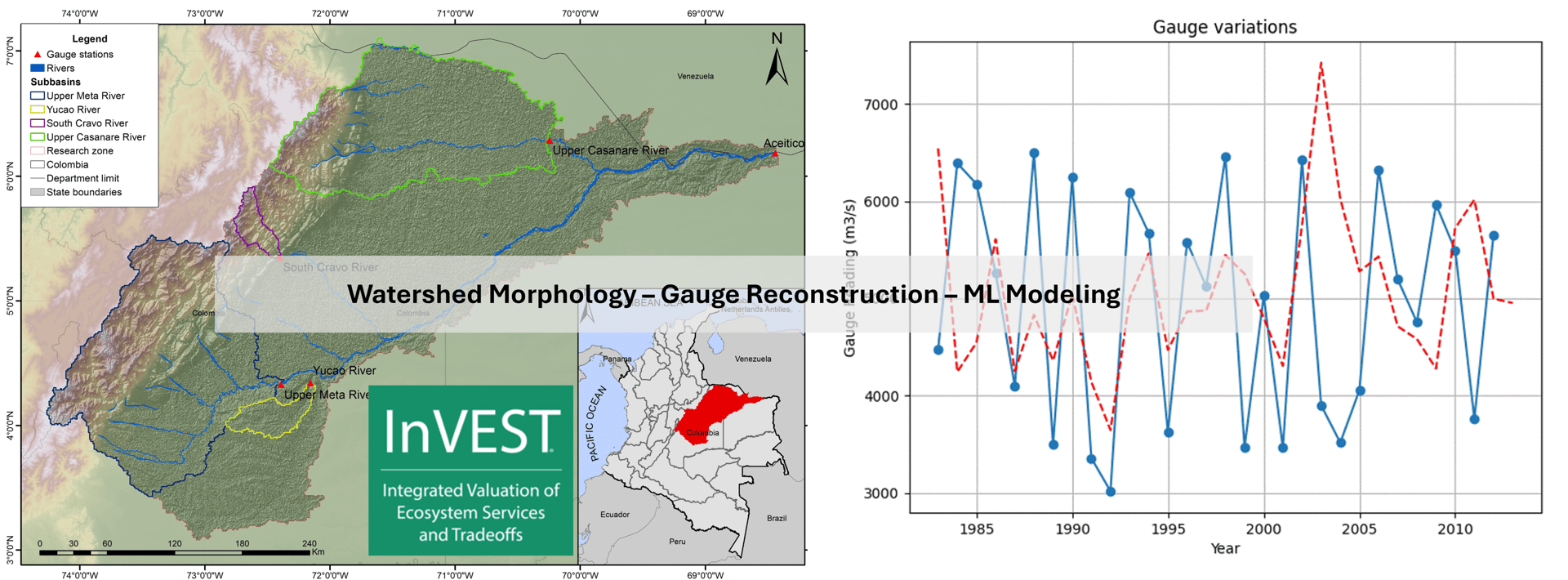
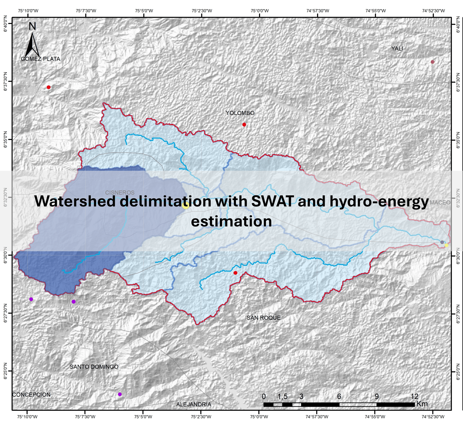
Water Modeling
Solutions ranging from basic to advanced modeling
Modeling for water management and energy production
Water projections using CMIP6 scenarios
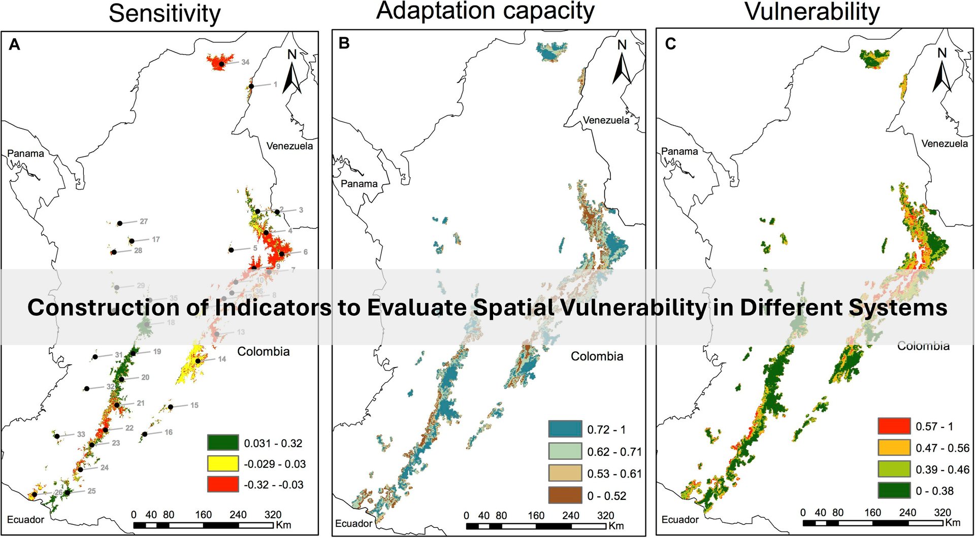
Climate Change Projections
Measuring the impact on agriculture, water, and energy
Working with both CMIP5 and CMIP6 scenarios
Integrating climate models for clear insights
Machine Learning Models:
Building models to solve various problems.
Applications in hydrology, climate, and agriculture.
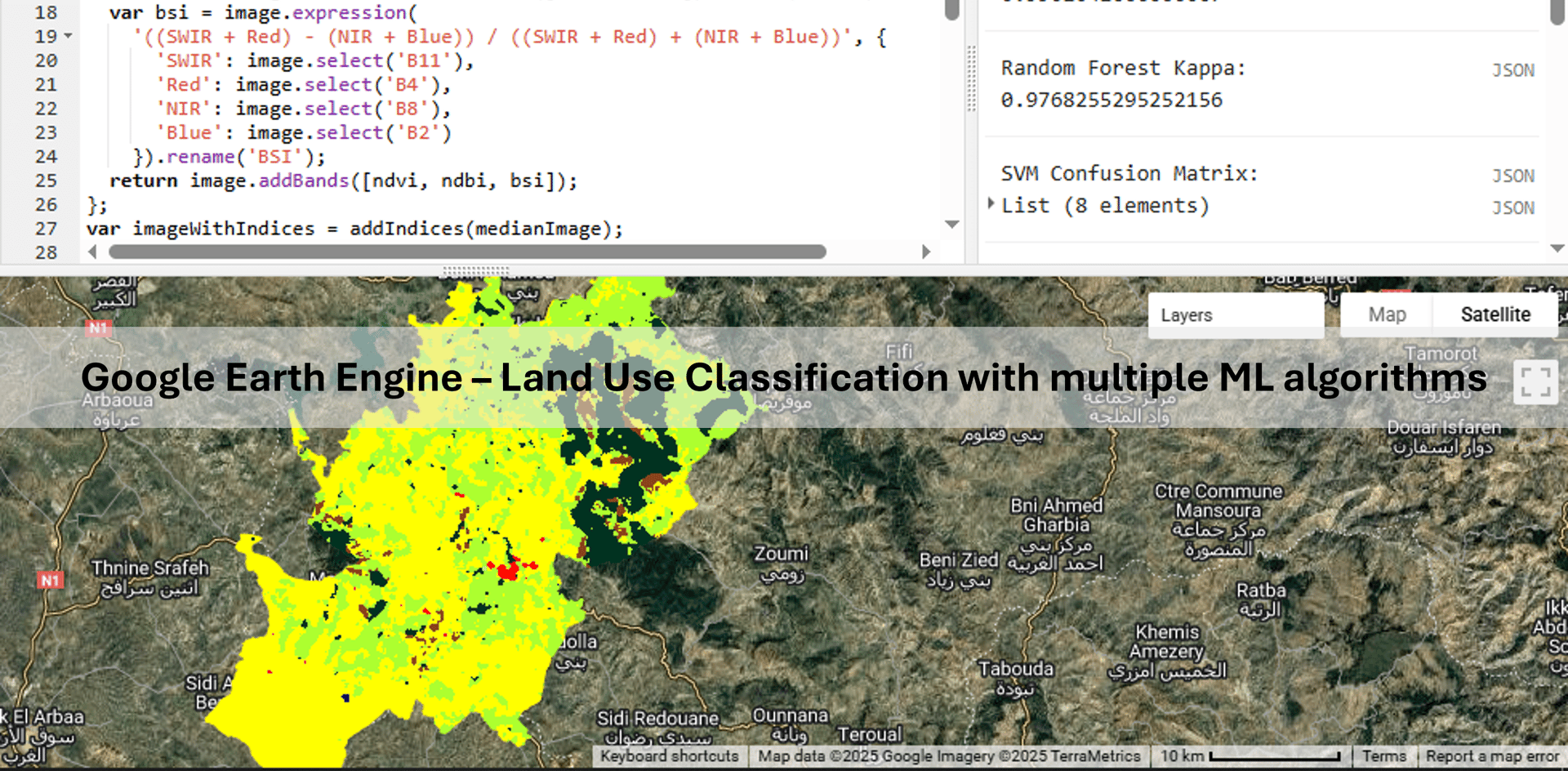
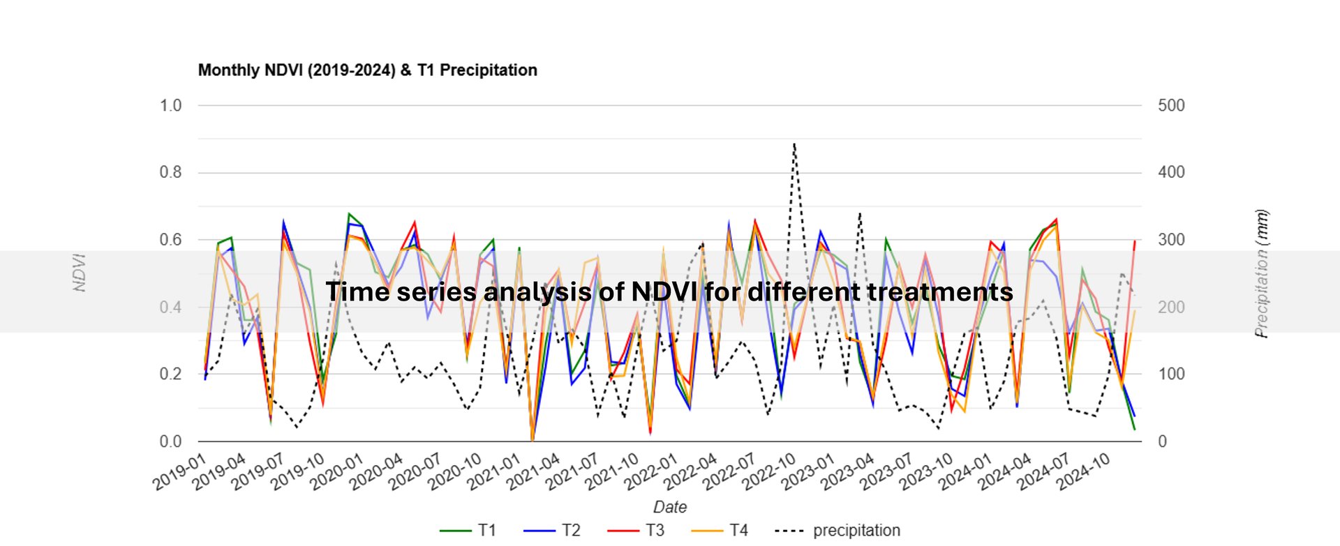
Remote Sensing:
Monitoring crop evolution with plant indicators.
Land use classification.
Open research
We value transparency
Our methods and code are open for review by our clients
Client Feedback
Discover how our expertise transforms climate-related challenges into actionable insights.
Climaquantis provided invaluable insights into our water modeling project, significantly enhancing our understanding of climate impacts on local ecosystems.
Sarah Thompson
San Francisco
The consultancy's depth of knowledge in GIS applications has greatly improved our precision agriculture strategies, leading to more sustainable practices and better resource management in our operations.
Mark Johnson
New York